Koh Ker
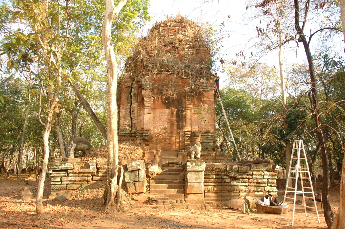
The area lies in the north-eastern part of Cambodia, between the Dangrek, Kulen and Tbeng mountains, some 120 kilometres northeast of Angkor and Siem Reap, in Preah Vihear Province. This hilly area is largely forested, but some of the trees lose their foliage periodically in the dry season. The sparsely populated area of some 81 square kilometres has about 200 temples, smaller shrines and other carved monuments. The area, whose modern name is Koh Ker, presumably derived from the name Chok Gargiar, meaning 'grove of koki trees', was the centre of the Khmer Empire in the middle of the 10th century. After his ascension to the throne in 928, King Jayavarman IV moved the royal capital there from the Angkor Plain. His brief, 20-year reign was the golden age of Koh Ker. Some inscriptions call the area “the city of lingas” or “the city of radiance”, because major architectural works were undertaken there under Jayavarman IV that also led to the development of the Koh Ker style, unique within Khmer art. The large reservoir and Prasat Thom, the seven-tiered pyramid temple that is unparalleled in Khmer architecture as well as some forty other temples were all built during his reign.
In 941, Jayavarman IV was succeeded on the throne by one of his sons, Harshavarman II, but after his brief reign, the next king returned the royal seat to the Angkor Plain in 944. Although the area thereby lost its political significance, it continued to play an important role in the religious life of the empire.
Koh Ker was rediscovered in the second half of the 19th century by French travellers, who were followed by expeditions for the exploration of the area. However, along with the explorers, adventurers seeking treasure also arrived and began a systematic looting of the area. In the 20th century, under the Khmer Rouge, the retreating Red Khmers mined Koh Ker. That perhaps partly explains why Koh Ker continued to be isolated and obscure until the area was cleared of mines and tourists began to visit it. Today, the established tourist route provides easy access to some 20 temples and 5 or 6 smaller monuments, but minor paths are available to reach a further 40 ruins. Koh Ker has been on the UNESCO Tentative World Heritage List since 1992.
LIDAR survey
LiDAR (Light Detection And Ranging or Laser Imaging Detection and Ranging) is an optical remote sensing technology that measures the properties of scattered light to find range and/or other information from a distant target. The prevalent method of determining distance to an object or surface is to use laser pulses―somewhat like radar technology, which uses radio waves―a light outside the visible spectrum, the range of an object being determined by measuring the time delay between transmission of a pulse and detection of the reflected signal.
Considering the general mine situation in the Koh Ker Area, a decision has been made to order an airborne LiDAR survey of the area. LiDAR efficiently produces high definition, high accuracy terrain, elevation and canopy models. Its aerial images can also be used for detailed mapping of the target area.
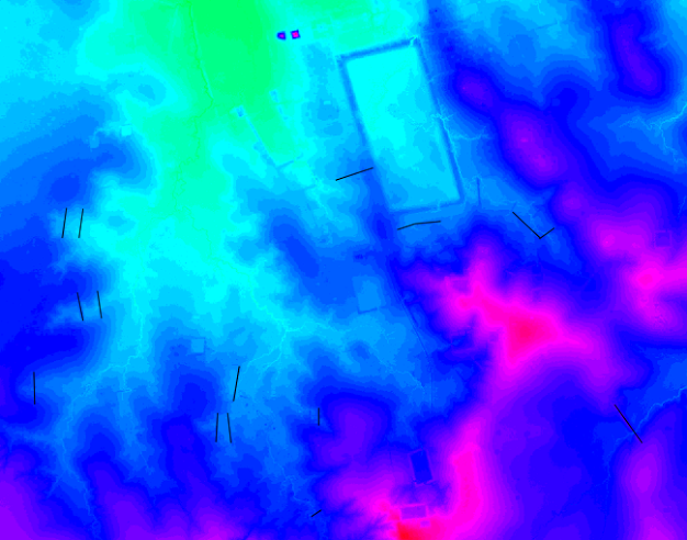
In April, 2012 a LiDAR survey was undertaken in the Koh Ker area as a part of a larger data acquisition project. Financed by HUNINCO and under the guidance of a co-operation agreement between the Hungarian Southeast Asian Research Institute and APSARA Authority, the fieldwork phase of the LiDAR based analysis is planned to begin in 2013. Also, the first publication will be presented later this year as a part of the KALC consortium that coordinated the 2012 flight. We expect significant results in determining the ancient settlement patterns through the fine sensitivity of LiDAR surface models